Like Urban Research on Facebook

Wednesday, July 25, 2012

The Art as Cultural Diplomacy Conference: A Forum for Young Leaders (London, Weeklong Seminar, August 24th – 27th, 2012)

The ICD Young Leaders Forums are international networks of like-minded young individuals with an interest in developing, supporting, and sustaining intercultural relations. The first Young Leaders' Forum was developed in 2003, and we have since developed and launched a variety of different bilateral and multilateral forums that focus on a diverse range of relationships across the world. Over the past decade, the ICD Young Leaders' Forum has grown to become one of Europe’s largest independent cultural exchange organizations, hosting programs that facilitate interaction among young individuals of all cultural, academic, and professional backgrounds, from across the world.
The speakers during the conference will include leading figures and experts from international politics (including head of states and ministers), diplomacy, academia, culture & the arts, civil society, and the private sector.

These speakers will include a number of individuals from the ICD Advisory Board.
The forum is open to applications from students and young professionals with an active interest in art & music, cultural studies, international relations, political science, peace studies, and diplomacy, as well as other interested stakeholders from around the world.


more conferences:

Call for paper for the special issue of INTERNATIONAL JOURNAL OF CO-OPERATIVE MANAGEMENT: “The Governance of Co-operative Housing: Current Challenges and Future Perspectives”

Call for Papers: The inaugural conference of the Travel Research Network will be held at The University of Melbourne, 18-20 July 2012

Call for Papers: Moving boundaries in mobilities research

Call for Papers: Spaces and flows 2012: Third international conference on urban and extraurban studies

Tuesday, July 24, 2012

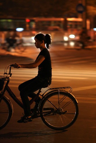
The bicycle's long way to China: The appropriation of cycling as a foreign cultural technique (1860-1941)

by Amri Moghaddas Esfehani

China -today the nation with the largest fleet of bicycles in the world- is surprisingly underrepresented in cycle history: we know nearly nothing about Chinese cycle history, cycle production, cycling habits or other aspects of the bicycle in China.
This contribution presents first results from historical Chinese sources, which were collected for my doctoral thesis, on China's cycle history around the turn of the century (1880s to 1920s). The article intends to give a chronological overview of the introduction and spread of the bicycle in China, from the first written account, to the founding of the People's Republic of China in 1949. It takes up the question of how Chinese contemporaries of the late 19th and early 20th century perceived the bicycle, as a technically new and culturally foreign means of transportation. The paper illustrates the process of cultural appropriation in the changing terminology for the bicycle.

A chronology of Chinese cycle history
1860s. The earliest Chinese reports and official perception of the bicycle 
Shortly after Michaux' construction of the pedal-driven prototype of a bicycle, and even some months before the invention became known to the European public, a selected Chinese readership learned of a new "cycling device" from the travel notes of a Chinese official. The author, Binchun, had just returned from his journey to Western Europe. As member of the first group of high-ranking Chinese officials, he had visited France, Great Britain, Germany and other nations between March and July 1866. After his return, he reported to the court on various curiosities he had discovered during his mission in the West. Among these he had seen in Paris two types of a strange device:
"On the avenues", Binchun writes, "people ride on a vehicle with only two wheels, which is held together by a pipe. They sit above this pipe and push forward with movements of their feet, thus keeping the vehicle moving. There's yet another kind of construction which is propelled by foot pedaling. They dash along like galloping horses." (Binchun, Chengcha Biji, 1866/68)
Binchun's delegation was formally sent on a diplomatic mission, but the participants had been instructed by the Chinese imperial court to investigate the latest trends in industrial development, administrative structure, and military technology. They were therefore very aware of all kinds of technical constructions. But while other technological discoveries of their visits -especially the steam engine and its mobile sister, the railway- are reported on in depth, and critically considered by the court officials with a view to their practical application towards the modernization of China's economy, the velocipede is not commented on in any known official source.
To assess the degree to which the introduction of modern technological products challenged Chinese society at the end of the 19th century and later, one has to take into account the need for industrialization and modernization in China. Military defeats and treaties after the 1840s triggered this, the Chinese saw them as humiliations, and they were closely connected to a sinking self-esteem.

Untitled
more about urban China:
The Unsquared Circle of Old Shanghai

Reliable and valid NEWS for Chinese seniors: measuring perceived neighborhood attributes related to walking

SOM wins Beijing Bohai Innovation City Master Plan Competition

Towards a walkable city: the planning practice of Shenzhen, China

World’s largest bike-share system in China dwarfs popular U.S. program

Can Beijing regain its status as the world’s “bicycle kingdom”?

China's Urban Low Carbon Future in Shanghai

REMOTE SENSING IMAGE INTERPRETATION STUDY SERVING URBAN PLANNING BASED ON GIS

Wednesday, July 18, 2012

An investigation of urban systems using entropy and elasticity measures: case study of North Region of Iran

by Nader Zali, Ali Soltani and Ahmad Panahi

Achieving a balanced distribution of population and activities over space is one of the critical goals of spatial planning profession. This paper reviews the status of this issue for the North Region of Iran including provinces of Mazandaran, Giulan and Golestan. The study applied two well-known methods including entropy and elasticity for measuring the extent of regional balance of population distribution throughout the study area. The results showed that the disorder of urban system has been increased dramatically along with fast population increase. Three capital cities of the region have experienced focal concentration whereas small cities have encountered with stagnation in population growth. Those cities with 50 thousand people and over have showed higher tendency to absorb further population. These trends have resulted in intensifying irregularity of urban system and emerging of new megacities.


more about urban Iran:

Changes in population settlement pattern in urban system of Tehran province (1966 to 2006)

Abadan: planning and architecture under the Anglo- Iranian Oil Company

Good Governance, (as promoting in decision-making process) and its influence on urban strategic plans

Tehran and the challenges of a metropolis in the millennium

Interconnections of Urban Green Spaces and Environmental Quality of Tehran

STRATEGY FOR SUSTAINABLE URBAN DEVELOPMENT GUIDELINES FOR TEHRAN

AIR QUALITY MANAGEMENT IN TEHRAN

IRAN’S MASHHAD LRT OPEN

Urban Planning for Tehran, By Using Environmental Modeling and GIS/RS

Tuesday, July 17, 2012

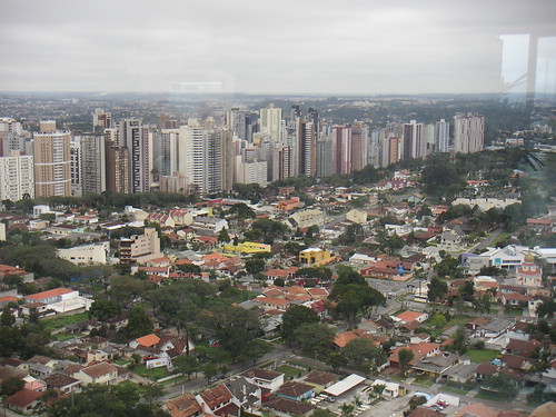
Land use pattern and transport in Curitiba

by Harry Smith and Jeremy Raemaekers

This paper examines the degree of success of the city of Curitiba, Brazil, in controlling the energy expended in transport through integrated land use and transport planning. Three key variable settlement shape, density and location of activities---are applied to the investigation of this rare built example of a linear city. Conclusions are drawn which enable us to compare this city's experience favourably with Western cities, in terms of fuel burn, whilst also raising doubts about the validity of this experience as a benchmark in the context of developing countries.


Line of Buildings, Curitiba

more about Latin America:

Skyline photos of Buenos Aires, Argentina (2)

Promoting Sustainable Transport in Latin America through Mass Transit Technologies

Sustainable human settlements development in Latin America and the Caribbean

SUSTAINABLE TRANSPORT PLANNING: A METHODOLOGICAL APPROACH

Brasilia, Brazil: economic and social costs of dispersion

MEXICO: Capital Badly in Need of Urban Regeneration

A Car Becomes a Weapon in Brazil; Pedestrians Shortchanged in Detroit

Inequality and Urban Shrinkage: A Close Relationship in Latin America

Thursday, July 12, 2012

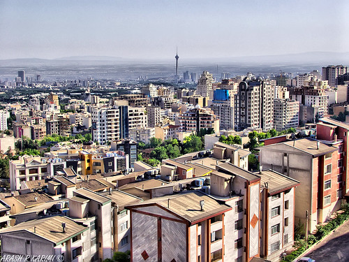
Changes in population settlement pattern in urban system of Tehran province (1966 to 2006)

by Abolfazl Meshkini and Hojatollah Rahimi

Rapid suburbanization in urban system of Tehran province has been driven by the government’s policies in past decades, transport system development and land price differences between metropolises and Periphery area. Cities in Periphery area grew rapidly during 1966 to 1986 as families moved there in anticipation of jobs. The non-appearance of jobs resulted in poor social services, gridlocked freeways and long travel distances to metropolises for job. The aim of this paper was to investigate how population settlement pattern in urban system of Tehran province USTP have been changed during 1966 to 2006. Methods adopted for this purpose were Mehta index, entropy coefficient and urban development model. Furthermore, for more analysis paper was supported by some theories such as system theory, primate city theory, basic economy theory, suburbanization theories, etc. Secondary data used in this paper were collected from governmental organizations (statistical data and map). Results show that growth of big cities in number and in population is the most considerable change which has been happened in urban system of Tehran province (USTP). What make it critical is their short distance from Tehran and Karaj. The paper argues that although distribution both in urban population and in urban points occurred during 1966 to 2006. But it is very important that where the destination of population flows. Because of their short distance, big cities exert double pressure on infrastructures of metropolises and agricultural lands in periphery area. The paper recommends seeking new structures for management in USTP because roots of change pressure extend beyond individual city.


Tehran and Milad Tower (HDR)
more about urban Iran:

Abadan: planning and architecture under the Anglo- Iranian Oil Company

Good Governance, (as promoting in decision-making process) and its influence on urban strategic plans

Strategy for Sustainable Urban Development: A Case Study of Urmia City, Iran

THE ROLE OF PHYSICAL IDENTITY OF CITY IN URBAN SUSTAINABILITY (THE CASE STUDY: YAZD,IRAN)

Interconnections of Urban Green Spaces and Environmental Quality of Tehran

A GIS-based Traffic Control Strategy Planning at Urban Intersections

AIR QUALITY MANAGEMENT IN TEHRAN

URBAN SPRAWL AND CLIMATIC CHANGES IN TEHRAN

Tuesday, July 3, 2012

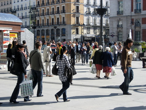
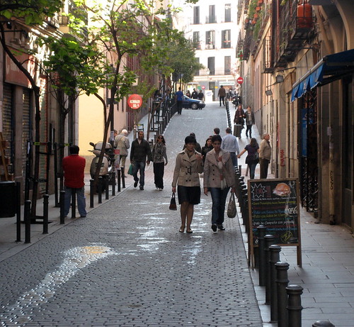
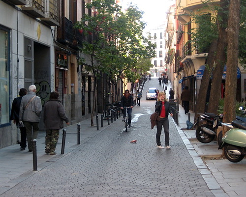
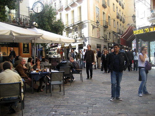
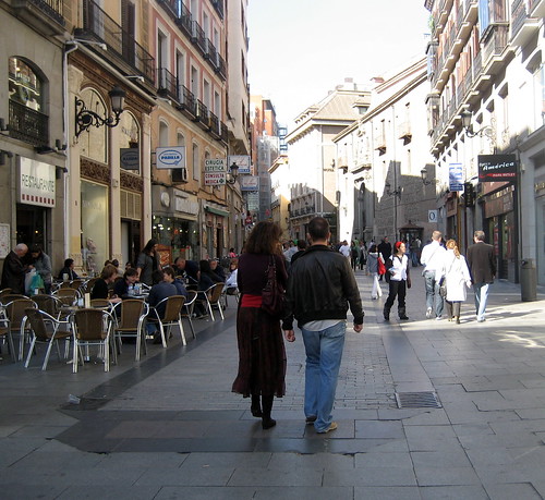
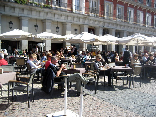
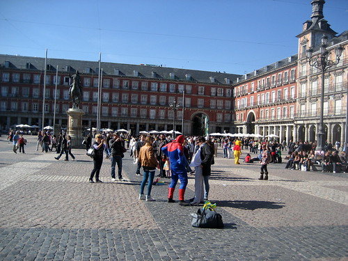
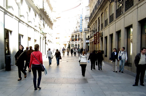
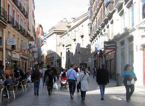
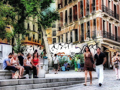
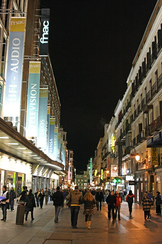
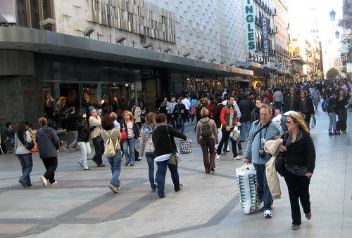
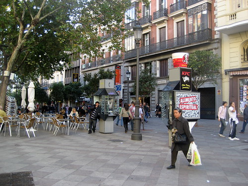
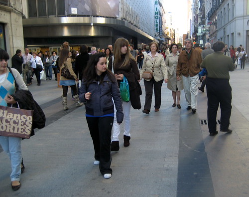
Pedestrian streets and shared spaces in Madrid, Spain (2)

Madrid Pedestrian Zone_14_Oct09-mk Madrid Shared Space Madrid Shared Space Madrid Pedestrian Zone_Oct09-mk Madrid Pedestrian Zone_16_Oct09-mk Madrid Plaza de Mayor_Oct09-mk Madrid Plaza de Mayor_Oct09-mk Madrid Pedestrian Zone_Oct09-mk Madrid Pedestrian Zone_Oct09-mk Tarde de verano en Madrid - Summer evening in Madrid downtown madrid on a tuesday night Madrid Pedestrian Zone_Oct09-mk Madrid Pedestrian Zone_Oct09-mk Madrid Pedestrian Zone_Oct09-mk
more about urban Spain:

Photos of pedestrian streets in Barcelona, Spain (1)

Potos of pedestrian spaces in downtown Madrid, Spain (1)

MONITORING URBAN SPRAWL AROUND BARCELONA’S METROPOLITAN AREA WITH THE AID OF SATELLITE IMAGERY

Skyline photos of Barcelona 1

ARCHITECTURAL STYLES IN ANDALUCIA

A new architectural landmark in Barcelona: Torre Telefónica Diagonal ZeroZero by EMBA

Montjuic Communications Tower built for the 1992 Olympics in Barcelona


Explaining International IT Application Le adership: Intelligent Transportation Systems

by Stephen Ezell

Information technology (IT) has transformed many industries, from education to health care to government, and is now in the early stages of transforming transportation systems. While many think improving a country’s transportation system solely means building new roads or repairing aging infrastructures, the future of transportation lies not only in concrete and steel, but also increasingly in using IT. IT enables elements within the transportation system—vehicles, roads, traffic lights, message signs, etc.—to become intelligent by embedding them with microchips and sensors and empowering them to communicate with each other through wireless technologies. In the leading nations in the world, ITS bring significant improvement in transportation system performance, including reduced congestion and increased safety and traveler convenience. Unfortunately, the United States lags the global leaders, particularly Japan, Singapore, and South Korea in ITS deployment. For the most part, this has been the result of two key factors: a continued lack of adequate funding for ITS and the lack of the right organizational system to drive ITS in the United States, particularly the lack of a federally led approach, as opposed to the “every state on its own approach” that has prevailed to date.

read more

more about urban transportation:

The New Urban Acupuncture: Intermodal Nodes between Theory and Practice

Los Angeles Streetcars: A Push To Bring Back The Rich History Of Streetcars Begins In Downtown LA

Putting the American Commitment to High-Speed Rail in Context

Grid Unlocked: How Street Networks Evolve as Cities Grow

Modelling Perceived Accessibility to Urban Amenities Using Fuzzy Logic, Transportation GIS and Origin-Destination Surveys

A Methodology for Incorporating Fuel Price Impacts into Short-term Transit Ridership Forecasts

Building Communications for Intelligent Transportation Systems A

Building Communications for Intelligent Transportation Systems A

A TROPOS NETWORKS WHITE PAPER

Intelligent Transport Systems (ITS) is an umbrella term for a wide range of information technologies that are applied to transportation infrastructure and vehicles. ITS uses advanced information and communications technologies to improve safety, relieve congestion, enhance productivity and reduce emissions. A metroscale wireless broadband IP network can provide a cost-effective foundation for securely hosting a wide range of ITS applications across a broad coverage area.
ITS offers important benefi ts to a variety of constituencies in communities. Public transit systems and their riders benefi t from reduced travel time and variability, improved schedule adherence, increased usage and provision of realtime information to transit riders. Public safety agencies and offi cers, as well as the public, enjoy reduced emergency response times, less aggressive driving, fewer severe accident and improved traffi c law compliance. Transportation departments can gather travel time and traffi c volume data to better plan street improvements and adjust signal timing. Drivers benefi t from decreased congestion, improved traffi c fl ow, shorter travel times and reduced fuel consumption. ITS can also increase parking space availability in prime areas. The environment can benefi t from reduced emissions, improving air quality. This paper describes leading ITS applications and their benefi ts. It also describes how wireless IP broadband mesh networks have become an increasingly important component in enhancing intelligent transportation systems, offering signifi cant advantages over landline and cellular alternatives.


more about urban transportation:

URBAN PLANNING AND DEVELOPMENT OF THE AUSTRALIAN CAPITAL TERRITORY, CANBERRA: A CRITICAL REVIEW

URBAN TRIP DISTRIBUTION MODELS: ANALYSIS OF SPATIAL RESIDUAL ERRORS AND SOME IMPLICATIONS FOR TRANSPORTATION POLICY AND RESEARCH

Towards a Sustainable Transportation Environment: The Case of “Pedicabs” and Cycling in the Philippines

THE IMPACT OF URBAN DEVELOPMENT ON AIR QUALITY AND ENERGY USE

The New Urban Acupuncture: Intermodal Nodes between Theory and Practice

The Management of Intermodality in Urban Transportation

Monday, July 2, 2012

Cairo’s Informal Areas Between Urban Challenges and Hidden Potentials

by Regina Kipper and Marion Fischer (ed.)

Cairo is a chaotic megalopolis where life is characterized by extremes, both of tradition and of modernity. When people are asked what the city means to them, individual answers vary tremendously, depending on a person’s relationship to the place. Tourists, for example, or those who have not been there, may think of the pyramids, the pharaohs, the Nile, Islamic Cairo, or perhaps a generalized image of ‘the Orient.’ The responses of Cairenes, however, tend to describe aspects of their everyday lives, problems such as “traffic jams,” “pollution,” “noise,” or “crowdedness.” Today’s Cairo, like any city of comparable size, can be a frustrating place for both residents and visitors alike. But Cairo is also a place where people find many occasions to celebrate together, and where visitors are welcomed with sincere openness. In short, Cairo is a diverse city of stark contrasts.
The importance of Cairo, the capital of Egypt, is highlighted by the city’s several names—al-Qahirah (‘the Victorious’), Umm al-Dunia (‘Mother of the World’), or simply Masr (the Arabic name for the nation as a whole). Cairo is by far the largest city in the country, and its dominance is underlined by the fact that Alexandria, the second most populous city, is only one-third of the capital’s size.
According to the 2006 census, around a quarter of Egypt’s approximately 73 million inhabitants live in Cairo, amounting to nearly half the country’s urban population. Egypt’s other cities seem almost provincial by comparison.
It is not simply its physical size or the number of its inhabitants that account for Cairo’s status as Egypt’s principal city. The country’s economic and political life is also concentrated there. Most of Egyptian industry, as well as many jobs in the secondary (manufacturing) and tertiary (services) sectors, are located in the capital. In the past, this centralization of jobs has led to a massive migration of rural populations to Cairo in search of jobs and an improved living situation. In terms of investment and development, Egypt can be seen as a country of two speeds, with a huge gap between the fast-paced city and the much slower rural and peri-urban areas. Everything in Cairo is faster than in other parts of Egypt: the growth rate of the city, the traffic, and the pace of life in general.
Cairo is also a historic city. Among the earliest settlements along the Nile was Memphis, capital of the ancient, united pharaonic kingdom, southwest of the future location of Cairo. Although little remains of this site, much of its stone was reused to build what is today known as Islamic Cairo. Because of the vast urban sprawl of Greater Cairo, the city now reaches to the very feet of the pyramids. Egypt’s ancient heritage can be seen in various locations throughout the city, but air pollution frequently obscures the view of these large and most famous monuments. Islamic settlement in the area of Cairo can be dated to 643 AD and the foundation of Fustat. The city known as Cairo was founded in the 10th century, and the monuments of the Fatimid and Mameluk dynasties can be found in the area that once comprised this medieval quarter. In fact, Islamic Cairo is said to have the highest concentration of historical sites per square kilometer in the world:
in an area of three square kilometers there are 500 registered historic monuments. Although some of these are in very poor condition, there are initiatives aiming at the restoration of historical areas and buildings. These areas—with their numerous mosques, minarets, and mausoleums—are surpassingly beautiful.
Cairo is a tourist city, as well. Because of its many monuments and sites, it is among the most popular destinations in Egypt. The most frequently visited are the ancient pharaonic monuments, as well as the Egyptian Museum. The Khan al-Khalili souq (bazaar) is also very entertaining for tourists. Often, tourists combine a visit to Cairo with a vacation on the Red Sea, perhaps only staying in Cairo for a couple of days. As the trip may be fully organized, they rarely have free time to discover Cairo on their own and so leave the city with a very limited impression of it. Cairo, however, has far more to offer than the official tourist highlights.

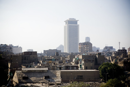
Panorama of old Cairo Cairo's Slums The Age of Extremes

more about the Middle East:

Abadan: planning and architecture under the Anglo- Iranian Oil Company

Good Governance, (as promoting in decision-making process) and its influence on urban strategic plans

Urbanization and Natural Disasters in the Mediterranean Population Growth and Climate Change in the 21st Century Case Studies on Izmit, Algiers and Alexandria

GATED COMMUNITIES: PHYSICAL CONSTRUCTION OR SOCIAL DESTRUCTION TOOL?

MESSAGE FROM TRADITIONAL SETTLEMENTS FOR FUTURE CITIES

Analyzing the State and Pattern of Urban Growth and City Planning in Amman Using Satellite Images and GIS

Revolutionary graffitis in the streets of Cairo, Egypt

The Middle Eastern Islamic City: Type and Morphology

Abadan: planning and architecture under the Anglo- Iranian Oil Company

by Mark Crinson

Industry and urbanization were brought to south-west Iran when large quantities of oil were struck there in the early years of this century. This paper explores the development of Abadan from these beginnings to the 1950s, and particularly the housing and planning forms adopted by the Anglo-Iranian Oil Company and its architect James M. Wilson. Abadan was in effect a colonial company town whose early development combined spacious bungalow compounds for British expatriate workers, barracklike lines of huts for labour recruited locally and from India, and a rapidly overcrowded ‘native town’ under local municipal control. The Company used Wilson’s expertise in an attempt to answer the physical problems created by the growth of Abadan between the wars and to deect pressure exerted both by Iranian nationalists and the British government. In the garden suburb of Bawarda he created a model solution that used planning and housing form to represent ethnic and social harmony under the discreet paternal benevolence of the Company. This, however, was inappropriate to Abadan’s problems and quickly eclipsed by the political events that led to the Company’s expulsion in 1951.


more about urban Iran:

The influence of urban physical form on trip generation, evidence from metropolitan Shiraz, Iran

Evaluating integration between public transportation and pedestrian-oriented urban spaces in two main metro stations of Tehran

Tehran's "Bike House" Shines Green

THE ROLE OF PHYSICAL IDENTITY OF CITY IN URBAN SUSTAINABILITY (THE CASE STUDY: YAZD,IRAN)

The Mechanism of Transformation of Shiraz City from Past to Present

Earthquake Management in Iran A compilation of literature on earthquake Management

Good Governance, (as promoting in decision-making process) and its influence on urban strategic plans

Good Governance, (as promoting in decision-making process) and its influence on urban strategic plans

by Seyed moslem seyed alhosseini

Experiences from urban development plans and assessments of their concrete and tangible results in the past decades indicate lack of adequate success of our urbanization system to responding needs of our citizens. This has resulted in need to find a fundamental solution to transforming the centralized system into decentralized. Recent changes in regard to a change of approach from master plan to strategic planning has resulted in an increased sensitivity with regard to enhancement of urban management in addition to the opinion that strategic planning is not in itself a credible replacement for technocratic master planning (top-down) and is not on its own sufficient for sustainable development. In this article, we employ methods of actualization and content analysis to compare the common features of two issues in Iran and subsequently, with an emphasis on correction of structure of urban management system, the concepts of participation of citizens, government, private sector and civic society and enhancement of “good urban governance” with “strategic planning approach” are discussed as keys to the question of solid development.“Public participation in decision-making, accountability, equity and efficiency”, defines both fundamental principles of good urban governance and characteristics of strategic planning and is essentials of a constant environmental, social and economic development.


more about urban planning in Iran:

Strategy for Sustainable Urban Development: A Case Study of Urmia City, Iran

Studying the effects of urban sprawl of metropolis on tourism - climate index oscillation: A case study of Tehran city

An Analysis to Challenges of Urban Management in Historic Center of Cities in Iran

COMPARATIVE SUSTAINABILITY OF BAZAAR IN IRANIAN TRADITIONAL CITIES: CASE STUDIES IN ISFAHAN AND TABRIZ

The influence of urban physical form on trip generation, evidence from metropolitan Shiraz, Iran

Changes in population settlement pattern in urban system of Tehran province (1966 to 2006)

AIR QUALITY MANAGEMENT IN TEHRAN