Like Urban Research on Facebook

Tuesday, December 18, 2012

Modeling street connectivity, pedestrian movement and land-use according to standard GIS street network representations: A Comparative Study

by Ayse Ozbil, John Peponis, and Brian Stone

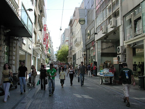
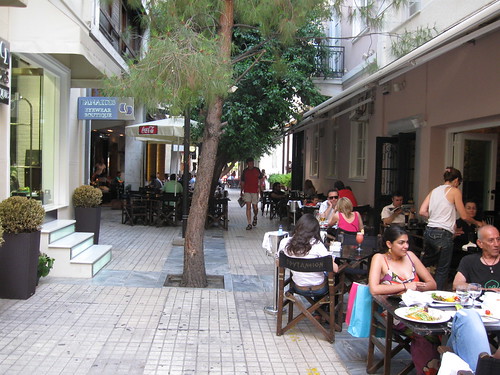
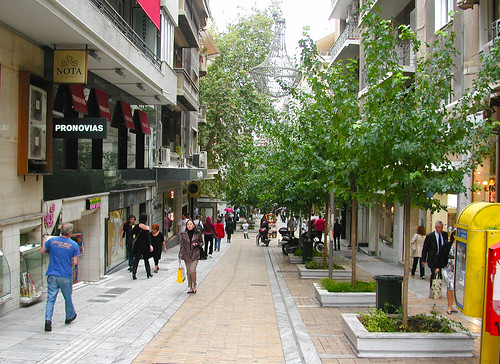
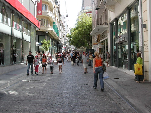
Two 1 mile x 1 mile areas in Atlanta and two 1 mile x 1 mile areas in Istanbul are compared to establish correlations between the distribution of pedestrian movement and street configuration. In each city, one area is chosen in the urban center and the other in one of the residential neighborhoods. The aim is to identify both underlying regularities that link street connectivity to pedestrian flows and differences regarding the volumes of pedestrian presence that can be traced to the influence of different modes of space appropriation. Based on pilot studies we expect to show that the volumes of pedestrian traffic per road segment can be post-dicted based on an analysis of standard GIS-based representations of street networks to implement two new measures of connectivity: reach, which measures the length of street network accessible within a given walking radius, and directional distance, which measures the number of direction turns needed to get to all accessible parts of the network. The work has several consequences. First, it complements existing work on the influence of density and design upon pedestrian movement by bringing into sharper focus a variable that clearly partakes of both design and density, namely the connectivity of the street network and its configuration. Second, it helps clarify that while land-use may play an important role in determining the average volume of movement in a given area, spatial layout plays a more important role in determining the distribution of movement within an area. This has consequences for at least some kinds of local urban economy as the comparative analysis will show: in Istanbul retail still relies on the “passing trade” more than it does in Atlanta because of the finer grain not only of the street network but also the size of businesses.


more about Space Syntax:

TRADITIONAL SHOPPING: A Syntactic Comparison of Commercial Spaces in Iran and Turkey

Can Betweenness Centrality Explain Traffic Flow?

Correlating Densities of Centrality and Activities in Cities: the Cases of Bologna (IT) and Barcelona (ES)

Correlating street centrality with commerce and service location in cities

Street Centrality and Densities of Retails and Services in Bologna, Italy

Evaluated Model of Pedestrian Movement Based on Space Syntax, Performance Measures and Artificial Neural Nets

THE STREETS OF INNOVATION: an exploratory analysis of knowledge transfer in the public realm

An integration of space syntax into GIS for modelling urban spaces

Sunday, December 9, 2012

Dynamic GPS-position correction for mobile pedestrian navigation and orientation

by Jason Daniel Martina, Jens Kröscheb,  and Susanne Boll

Location has become one of the most relevant context parameters for mobile applications. Technology for the positiong such as Global Positioning System (GPS) has been widely adopted for locating the mobile user. However, for mobile applications that use an off the shelf GPS-receiver such as a PCMCIA card attached to a PDA, the correctness of the positioning is yet unsatisfying. Especially pedestrians, walking in urban areas, may experience strong deviations of the detected position from their actual position. In this paper, we present our approach to provide a software-based solution for a more correct position to a mobile pedestrian by still relying on consumer-grade GPS receivers. The results are small-sized, however, promising.


more about pedestrianization:

Bridges to Utopia? A Sustainable Urban District in Freiburg, Germany

The new district of Freiburg-Rieselfeld: a case study of successful, sustainable urban development

A planned carfree neighborhood: Rieselfeld in Freiburg, Germany

Pedestrian (and stroller) priority in Vancouver

SMART GROWTH, SMART CHOICES SERIES: MIXED-USE DEVELOPMENT

Norwegian poetics – 2nd life of the industrial city

GPS in pedestrian and spatial behaviour surveys

GPS in pedestrian and spatial behaviour surveys

by Thomas S. Nielsen and Henrik Harder Hovgesen

The planning of the environment for pedestrian can be improved by using the newest gps tools for monitoring changes in human activity patters in time and space.
Using a personal GPS-device the locations and movements of respondents can be followed through a longer period of time. It will be possible to analyse how the use of urban spaces are embedded in a wider context of activity patterns (work, school etc.). The general patterning of everyday itineraries, including route choice and time spent at different locations “on the way” can also be analysed. If the personal GPS-device is combined with an electronic questionnaire, FX. in the shape of a Personal Digital Assistant (PDA) or cell phone, a whole new array of survey-possibilities comes into being. Respondents can be asked to register their activities, evaluate – or in other ways describe the attractiveness of places – based on their actual position in the urban area. Thus a new form of integration between research into activity patterns and urban places will be possible.
The paper presents the possibilities in spatial behaviour and pedestrian-surveys with GPS and electronic questionnaires. Demonstrative mapping of test data from passive GPS-registration of Copenhagen respondents is presented. The different survey-possibilities given a combination of GPS and PDA-based electronic questionnaire are presented – together with its possible applications in the context of pedestrian surveys.
more about pedestrian travels:

Perceptions of Accessibility to Neighborhood Retail and Other Public Services

Walking and cycling for sustainable mobility in Singapore

Residents’ perceptions of walkability attributes in objectively different neighbourhoods: a pilot study

Validating walkability indices: How do different households respond to the walkability of their neighbourhood?

Environmental Correlates of Walking and Cycling: Findings From the Transportation, Urban Design, and Planning Literatures

Friday, December 7, 2012

Lecture on sampling methods by Prof. Murtaza Haider

Defining the sample size is of great importance in the precision of the surveys. This issue is used in transportation and urban planning observations. Pof. Murtaza Haider from Ryerson University in Toronto, Canada explains about this topic in a lecture in the following video.


more about quantitative observations in urban transportation planning:

The Causal Influence of Neighborhood Design on Physical Activity Within the Neighborhood: Evidence from Northern CaHfornia

Urban Travel Route and Activity Choice Survey (UTRACS): An Internet-Based Prompted Recall Activity Travel Survey using GPS Data

Thursday, December 6, 2012

The impact of modernization on traditional Iranian cities the case of Kerman

by AZADEH ARJOMAND KERMANI and ERIC LUITEN

Historical urban centers in Iran are significant because of their population density and location, but also because of the major functions of the central buildings that are very often historical monuments and valuable urban ensembles. Historical urban quarters are special places not only because of the cultural heritage they house, but also because of their urban pattern.
Widening streets to facilitate automobile access to the historical fabric of the city has had a deleterious impact on the network of paths through the city, and has caused the spatial coherence of the ancient fabric to fracture.
The study of urban history reveals that a variety of factors have influenced the development of ancient cities, with one of the most important factors being the economy. In fact, the very survival of a city was highly dependent on its economic power. As the most significant pedestrian network and backbone of a city, the bazaar plays an important role in the development and livability of traditional Iranian cities. Located along the Silk Road, Kerman, which was once a trading metropolis of international renown, has one of the most historical bazaars in Iran. Kerman was chosen for its location and the role its bazaar once played in the formation of the city itself. This paper analyzes two examples of where modern construction and the old urban bazaar intersect, and discusses how the old urban texture is being lost.


more about Iran:

The Mechanism of Transformation of Shiraz City from Past to Present

Earthquake Management in Iran A compilation of literature on earthquake Management

Tehran and the challenges of a metropolis in the millennium

A GIS-based Traffic Control Strategy Planning at Urban Intersections

THE IDENTITY OF OPEN SPACE: ADAPTING FROM THE MODEL OF TRADITIONAL NEIGHBORHOOD CENTER

A new approach to the Iranian urban planning, using neo-traditional development

URBAN SPRAWL IN IRANIAN CITIES AND ITS DIFFERENCES WITH THE WESTERN SPRAWL

THE IDENTITY OF OPEN SPACE: ADAPTING FROM THE MODEL OF TRADITIONAL NEIGHBORHOOD CENTER

by V. Ahmadi, A.I. Che-Ani, H.Farkisch, and M.Surat

The City form consists of some different elements, which have been joined in the functional and spatial form. If these elements have an appropriate spatial organization the strong coherence is created among them. In the traditional urban spaces, most of the times, this spatial regularity among city elements is the result of thoughtful developed urban patterns. Many non-local agents influence on the form of new cities while the forming of traditional urban spaces depends on the morphology of the site, the historical background and the culture of local people. In this way, we were looking for some of the important researches by focus the open spaces and exactly neighborhood centers in Iran. We also choose the analysis literature review for our methodology. All our attention was on two case studies in Iran (Tehran and Shiraz). In this paper, we tried to find ways to evaluate the value of neighborhood centers in the traditional urban for fulfillment to sustainable development urbanism. Urban planners and designers should find out the secret of the traditional cities' sustainability and the factors which make the responsive environment, and think that what the reasons prevent using them in contemporary cities. And then they should find a way to update those factors based on today demands, and design new patterns according to old one.


North of Tehran

more about Iranian urbanism and urban planning:

TRADITIONAL SHOPPING: A Syntactic Comparison of Commercial Spaces in Iran and Turkey

A new approach to the Iranian urban planning, using neo-traditional development

URBAN SPRAWL IN IRANIAN CITIES AND ITS DIFFERENCES WITH THE WESTERN SPRAWL

Changes in population settlement pattern in urban system of Tehran province (1966 to 2006)

Evaluating integration between public transportation and pedestrian-oriented urban spaces in two main metro stations of Tehran

THE ROLE OF PHYSICAL IDENTITY OF CITY IN URBAN SUSTAINABILITY (THE CASE STUDY: YAZD,IRAN)

Good Governance, (as promoting in decision-making process) and its influence on urban strategic plans

Abadan: planning and architecture under the Anglo- Iranian Oil Company

Tuesday, December 4, 2012

Call for papers: JDR’s Special Issue on Great East Japan Earthquake

The Journal of Disaster Research (JDR) publishes special issues on the Great East Japan Earthquake. To make the most of this critical experience of the earthquake disaster as a yardstick for disaster prevention in the future, we call for research papers, survey reports, analyses and proposals related to the Great East Japan Earthquake from diverse perspectives. The special issues will be published annually from August 2012 (published) for five years. We look forward to your submission.

Objective
The Great East Japan Earthquake has caused an unprecedented scale of damage and had widespread effects. There is a need to study the actual condition of damages and countermeasures against disasters from a wide-ranging perspective and on a long-time basis. JDR will annually publish special issues on the Great East Japan Earthquake beginning in 2012, for five years, for the purpose of informing, recording and utilizing lessons learned from the earthquake. Page charges are in principle free. We call for papers through our website or other media, and expect contributions from a broad array of fields.

Study Area
The study area is not specified. We call for research papers, survey reports, analyses and proposals based on scientific or socio-scientific methods, on a wide range of topics related to the Great East Japan Earthquake. Examples of the study areas are as follows.
-Earthquake 
-Seismic motion 
-Tsunami
-Damage by earthquake 
-Damage by tsunami 
- Fire caused by tsunami
-Nuclear disaster 
-Countermeasures against radiation
- Countermeasures for disaster mitigation 
-Recovery and Reconstruction
-Risk management 
-Sanitation 
-Medical care
-Harmful rumors 
-Volunteer 
-Transportation problem
-Others

Deadline for the manuscript: April 1, 2013
Deadline for the final manuscript: May 15, 2013
Date of publication: September 1, 2013


more about disaster management:

Asian cities at highest risk to climate change, study says

Urbanization and Natural Disasters in the Mediterranean Population Growth and Climate Change in the 21st Century Case Studies on Izmit, Algiers and Alexandria

EVACUATION PLANNING IN EARTHQUAKE DISASTERS, USING RS & GIS

GIS based Earthquake Risk-Vulnerability Analysis and Post-quake Relief Planning

Hazard Mapping and Vulnerability Assessment

Augusta Practices Resilience in Fighting Floods

Friday, November 30, 2012

ANALYZING NEIGHBORHOOD RETAIL AND SERVICE CHANGE IN SIX CITIES

by C. Theodore Koebel

Little is known about neighborhood retail and service establishments, although they are often identified as positive attributes of successful neighborhoods and have been promoted through various community development programs. To date, research from urban and public policy fields has concentrated on the political economy of large-scale commercial development projects, particularly those promoted through public-private partnerships. Nonetheless, distressed neighborhood commercial districts present serious obstacles to the vitality of neighborhoods and the success of residential redevelopment. Consequently, neighborhood commercial spaces are often the focus of redevelopment programming. Our lack of knowledge about neighborhood retail and service establishments is itself an obstacle to community development.
The fundamental thesis of this research is that change in neighborhood retail and service establishments (number of establishments, employment size of establishment, number of employees, and payroll) is a function of market and non-market factors. The primary market factors relate to levels of demand from the residents of the businesses’ market areas and proximity to negative externalities in or near the neighborhood. The primary non-market factors are discrimination due to race and ethnicity, and the impact of household characteristics unrelated to demand.
The study uses a special data set for six cities (Baltimore, Boston, Chicago, Cleveland, Pittsburgh, and Oakland) and immediately surrounding counties. The data set includes 1980 and 1990 decennial census variables, and 1982-83 and 1992-93 mortgage volumes, as well as change measures for "stock" variables and rate of change measures for "flow" variables. Additional items (e.g. public housing units, distance to the CBD, and location of major retail centers outside the CBD) have been added to the data set. The dependent variable is the change in the number of establishments for neighborhood retail and service businesses. The current study overcomes previous impediments to analyzing neighborhood retail and service establishments by utilizing a special five-digit zip code data set from the CBP program and by aggregating census tracts to correspond to zip code areas.
Athens Grocery Store

more about centrality:

Can Betweenness Centrality Explain Traffic Flow?

Correlating Densities of Centrality and Activities in Cities: the Cases of Bologna (IT) and Barcelona (ES)

Geographically Weighted Regression: A Method for Exploring Spatial Nonstationarity

Correlating street centrality with commerce and service location in cities

Street Centrality and Densities of Retails and Services in Bologna, Italy

Street Centrality and Densities of Retails and Services in Bologna, Italy

Spatial Network Analysis of Public Transport Systems: Developing a Strategic Planning Tool to Assess the Congruence of Movement and Urban Structure in Australian Cities

Centrality in networks of urban streets

Thursday, November 29, 2012

TRADITIONAL SHOPPING: A Syntactic Comparison of Commercial Spaces in Iran and Turkey

by Erincik EDGÜ, Alper ÜNLÜ, Mehmet Emin ŞALGAMCIOĞLU, and Ashkan MANSOURI

Commerce is an ancient economical system that enables establishment of legal and ethical foundations, strengthening of social ties, improving cultural relationships, trading values and technology as well as goods. Trading routes necessitates places for accommodation and rest both for traders and pack animals, horses, camels, oxen and such. For many centuries, caravanserais helped as design solutions for this purpose. However as the stopping places on routes began to act as small trading towns, sarās or hans took over the accommodation service for traders. Although administrative, social, cultural, religious and linguistic distinctions present many functional and semantic variations, having situated on the ancient routes and ports of the Silk Road, cities and states of the west Asia have developed a traditional insight to shopping activity and design that are being preserved in the hearts of these ancient cities.
Although there may be predesigned grid or crisscross exceptions, in most cases, traditional Islamic commercial i.e. shopping spaces are built in time, with expansions in relation to the organic pattern of the city and street layouts. In Turkish social system, covered bazaars are usually built as a part of a larger complex including, hamams, soup kitchens, and such as a source of revenue for mosques, religious or charitable trusts known as vakıfs, where the donated assets cannot be turned over to individuals or institutions. In Iranian system however, covered bazaars are built by state authorities or wealthy individuals solely for the purpose of commerce, although the latter may also include mentioned public amenities. On the other hand, unlike Turkish organisations, having a strong political and/or religious demonstration tradition, Iranian covered bazaars act as a reflection of social indicator. This distinction presents formal variations in layout and attributes semantic uses to spaces as well.
Although sarās or hans were initially used for accommodation purposes in both cultures, they also act a guild for specific branch of trade or manufacturing with their enclosed square/rectangular forms having courtyards or eyvans. However, Iranian bazaar structure relies on linear shopping strips rāstās or arastas combined to compose chārsugs or çarşıs at intersections and meydans serving as the hubs of the network. In Turkish system on the other hand, bedesten, the covered and enclosed core building, where the most expensive and valuable goods are exchanged, determines the formation of the whole bazaar. This building and arastas of the Turkish bazaars are predesigned and built in single sessions without any expansion. Thus, although in both cultures, both organic and pre planned bazaar systems, developed from linear strips are seen, contrary to the articulated and clustered Iranian bazaars, Turkish bazaars formed through connection of arastas acting as gridiron building blocks. 
This research focuses on the comparison of the physical layout of Iranian and Turkish traditional covered bazaars in the context of Tabriz and Istanbul respectively. The usage of gathering spaces, articulation of nodes, connection of main or secondary axes in forms of hans, bedestens, eyvans, courtyards, meydans with streets or arastas and such, are the syntactic experiment areas of the research. The research hypothesis assumes that guild formation affects the articulation and spatial configuration of the spaces that in return changes the usage in terms of social gatherings versus pedestrian flow in the traditional covered bazaars.


Busy Morning @ Historic Grand Bazaar, Istanbul
more about Space Syntax:

Can Betweenness Centrality Explain Traffic Flow?

Correlating Densities of Centrality and Activities in Cities: the Cases of Bologna (IT) and Barcelona (ES)

An integration of space syntax into GIS for modelling urban spaces

An integration of space syntax into GIS for modelling urban spaces

SPATIAL GROWTH AND FUNCTION IN A JAVANESE COASTAL CITY

Agent-based Simulation of Human Movement Shaped by the Underlying Street Structure

Space Syntax and Transit Networks

Photos of pedestrian streets in downtown Athens, Greece

Pedestrian Street - Athens Pedestrian Street - Athens Pedestrian Street - Athens Pedestrian Street - Athens Plaka street scene Kolonaki pedestrian street 01 Reposessing the Realm-Fused Grid Pedestrian Street - Athens Ermou Street Pedestrian Street - Athens  
more street photos:

Photos of pedestrian urban spaces in Barcelona (2)

Pedestrian streets in inner Copenhagen city, Denmark

Photos of public spaces and pedestrian streets in Oslo, Norway

Pictures of the pedestrian streets in downtown Glasgow

The streets of central city of Aachen, Germany

Can Betweenness Centrality Explain Traffic Flow?

by Aisan Kazerani and Stephan Winter

Centrality measures describe structural properties of nodes (and edges) in a network. Betweenness centrality (Freeman 1977) is one of them, characterizing on how many shortest paths a node is. So far, network analysis concentrates on structural, i.e., topological properties of networks, and on static formulations of centrality. Although travel networks can be studied this way, they deviate from other networks in two significant ways: their embeddedness in geographic space is relevant, and their dynamic properties can not be neglected. For example, a physical urban street network constrains travel behavior in a way that people seek to satisfy their demands from physically near, not topologically near resources. Also, a physical street can have significant temporal constraints, such as night time closures, dynamic lane allocation, or current traffic volume, besides of slow rates of change in the network itself. This means, it is not appropriate to compare traffic flow on street networks with traditional betweenness centrality. 
Traffic flow is the process of physical agents moving along an urban travel network. These agents are autonomous, purposeful, flexible, and volatile. They establish a social network: agents near to each other can communicate and interact (other social ties, like kinship or friendship, are not considered here). Since the agents are mobile this social network is highly dynamic. Also agents are volatile. They enter traffic at any time, and leave as soon as they have reached their destination. The places where they emerge or disappear are distributed over space and time, but not in a random manner. Additionally, agents in urban traffic are purposeful. They have individual travel, sensing and communication capabilities, maybe even preferences, and a specific travel demand (to reach a destination by a specified time or specified costs). Especially, during travel they can interact with their fellow agents, be it by coordination (communication) or collaboration (transport), and they can sense and act in their physical environment, and thus, change their travel plans at any time to satisfy their travel demand. This means travel plans—if not the underlying travel demand itself—can be dynamic. This social network of agents in traffic can also be characterized by centrality measures; however, these measures are attributes of the agents, not of the nodes of the physical travel network, and they are constantly changing—hence, infeasible to track in a central database.


more baout Centrality:

Opportunities for transport mode change: an exploration of a disaggregated approach

Correlating Densities of Centrality and Activities in Cities: the Cases of Bologna (IT) and Barcelona (ES)

Geographically Weighted Regression: A Method for Exploring Spatial Nonstationarity

Correlating street centrality with commerce and service location in cities

Street Centrality and Densities of Retails and Services in Bologna, Italy

Centrality in networks of urban streets

Opportunities for transport mode change: an exploration of a disaggregated approach

by Martin Dijst, Tom de Jong, and Jan Ritsema van Eck

Research into the effects of spatial configuration on the use of transport modes has to date dominantly been based on analyses of actual travel behaviour or prediction of future transport mode choices. However, in this research it is not made clear what choice opportunities were available for travel behaviour of the various population categories, given their desired activities and time-space opportunities. The authors describe a time-space theoretical and methodological framework based on the concept of action spaces, within which the choice opportunities of different types of house- holds of various areas can be analysed. On the basis of a pilot study among the residents of a suburban neighbourhood in a Netherlands new town, the time space opportunities they have to use alternative transport modes other than the car are brought into the frame. It is shown that residents have more time-space opportunities to make use of existing environmentally friendly, transport modes than had been expected. The possibilities differ between types of action spaces and types of households. Some implications for policymaking are discussed. The authors state that policymakers should be more sensitive to interpersonal differences in accessibility.


Similar posts:

Correlating Densities of Centrality and Activities in Cities: the Cases of Bologna (IT) and Barcelona (ES)

Geographically Weighted Regression: A Method for Exploring Spatial Nonstationarity

Correlating street centrality with commerce and service location in cities

Street Centrality and Densities of Retails and Services in Bologna, Italy

Wednesday, November 28, 2012

Employment decentralization and and Transit-Oriented Development

The U.S. has experienced a decentralization of employment or in another word, employment sprawl during the last decades.This has increased traffic congestion and  car use/ownership. The following webinar explains how important is to concentrate jobs near transit. The speakers are Dena Belzer, the preseident of Strategic Economics and CTOD, Sujata Srivastava, from Strategic Economics and CTOD, Greg Leroy, the executive director of Good Jobs First, and Kate Mattice from Federal Transit Administration.


more about land use planning:

Correlating Densities of Centrality and Activities in Cities: the Cases of Bologna (IT) and Barcelona (ES)

A new approach to the Iranian urban planning, using neo-traditional development

Land use pattern and transport in Curitiba

Simulating land-use change in Portugal using an activitybased model

Research on Factors Relating to Density and Climate Change

Opportunities for transport mode change: an exploration of a disaggregated approach

Correlating Densities of Centrality and Activities in Cities: the Cases of Bologna (IT) and Barcelona (ES)

by Porta S, Latora V, Wang F, Rueda S, Cormenzana B, Càrdenas F, Latora L, Strano E, Belli E, Cardillo A, and Scellato S.

This paper examines the relationship between street centrality and densities of commercial and service activities in cities. The aim is to verify whether a correlation exists and whether some categories of economic activities, namely those scarcely specialized activities oriented to the general public and ordinary daily life, are more linked to street centrality than others. The metropolitan area of Barcelona (Spain) is investigated, and results are compared with those found in a previous work on the city of Bologna (Italy). Street centrality is calibrated in a multiple centrality assessment (MCA) model composed of multiple measures such as closeness, betweenness and straightness. Kernel density estimation (KDE) is used to transform data sets of centrality and activities to one scale unit for correlation analysis between them. Results indicate that retail and service activities in both Bologna and Barcelona tend to concentrate in areas with better centralities: in fact the spatial distribution of these activities correlates highly with both simple and compound measures of centrality. This confirms the hypothesis that street centrality plays a crucial role in shaping the formation of urban structure and land uses. Moreover, results suggest that a locational rule seems to link to street centrality those economic activities oriented to the general public.


more about Centrality:

Geographically Weighted Regression: A Method for Exploring Spatial Nonstationarity

Correlating street centrality with commerce and service location in cities

Street Centrality and Densities of Retails and Services in Bologna, Italy

Street Centrality and Densities of Retails and Services in Bologna, Italy

Spatial Network Analysis of Public Transport Systems: Developing a Strategic Planning Tool to Assess the Congruence of Movement and Urban Structure in Australian Cities

Centrality in networks of urban streets

Geographically Weighted Regression: A Method for Exploring Spatial Nonstationarity

by Chris Brunsdon, A. Stewart Fotheringham and Martin E. Charlton

Spatial nonstationarity is a condition in which a simple ‘global” model cannot explain the relationships between some sets of variables. The nature of the model must alter over space to reflect the structure within the data. In this paper, a technique is developed, termed geogra hically weighted regression, model which allows diferent relationships to exist at diferent points in space. This technique is loosely based on kernel regression. The method itself is introduced and related issues such as the choice of a spatial weighting function are discussed. Following this, a series of related statistical tests are considered which can be described generally as tests for spatial nonstationarity. Using Monte Carlo methods, techniques are proposed for investigatin the null non-stationa y one and also for testing whether individual regression coeficients are stable over geographic space. These techniques are demonstrated on a data set from the 1991 U. K. census relating car ownership rates to social class and mule unemployment. The paper concludes by discussing ways in which the technique can be extended.


Similar papers:

Correlating street centrality with commerce and service location in cities

Street Centrality and Densities of Retails and Services in Bologna, Italy

Correlating street centrality with commerce and service location in cities

by S. Porta and V. Latora

In this paper we are presenting a discussion of centrality in cities and a model, named Multiple Centrality Assessment (MCA) which helps in managing centrality for urban planning and design purposes. In so doing, we summarize a research that we have been undertaking for the last couple of years. In addition, we are hereby offering the results of a new line of research aimed at understanding the level of correlation between the centrality of streets and several other urban dynamics like the location of shops and services as well as that of workplaces. The whole research is worked out in a GIS (Geographic Information System) environment: the correlation analysis is addressed both directly (comparing centrality and dynamics on every arc of the street graph) and through a GWR (Geographic Weighted Regression) approach. Data are taken form real cities like Rome (IT), Barcelona (ES) and Bologna (IT).


more about Space Syntax and centrality:

Street Centrality and Densities of Retails and Services in Bologna, Italy

Spatial Network Analysis of Public Transport Systems: Developing a Strategic Planning Tool to Assess the Congruence of Movement and Urban Structure in Australian Cities

Centrality in networks of urban streets

Street Centrality and Densities of Retails and Services in Bologna, Italy

by Porta, S, Latora, V, Wang, F, Strano, E, Cardillo, A, Scellato, S, Iacoviello, V, Messora, R.

This paper examines the relationship between street centrality and densities of commercial and service activities in the city of Bologna, northern Italy. Street centrality is calibrated in a multiple centrality assessment (MCA) model composed of multiple measures such as closeness, betweenness and straightness. Kernel density estimation (KDE) is used to transform data sets of centrality and activities to one scale unit for correlation analysis between them. Results indicate that retail and service activities in Bologna tend to concentrate in areas with better centralities. The distribution of these activities correlates highly with the global betweenness of street network, and also to a slightly lesser extent, the global closeness. This confirms the hypothesis that street centrality plays a crucial role in shaping the formation of urban structure and land uses.
more about Space Syntax:

Centrality in networks of urban streets

An overview of urban morphology and micro-scale analysis

A presentation by Tim Stonor on "Spatial Layout Efficiency"

Social exclusion and transportation in Peachtree City Georgia

OPTIMAL LOCATION OF ROUTE AND STOPS OF PUBLIC TRANSPORTATION

Space Syntax and Transit Networks

Agent-based Simulation of Human Movement Shaped by the Underlying Street Structure

SPATIAL GROWTH AND FUNCTION IN A JAVANESE COASTAL CITY

Saturday, November 24, 2012

The characteristics, causes and costs of urban sprawl: a lecture by Reid Ewing

After more than fifteen years of working on the characteristics, causes, and costs of urban sprawl, Professor Reid Ewing from University of Utah explains about basics of urban sprawl in a lecture. He explains about the main characteristics of sprawl, like low density, segregation of uses, lack of strong centers, and sprase street networks. According to him measuring sprawl gives us opportunity to study it. Ewing has developed County Sprawl Index to measure urban sprawl. 
Wahtch the lecture:


more about urban sprawl:

A new approach to the Iranian urban planning, using neo-traditional development

Documentary film: Sprawling from Grace: The Consequences of Suburbanization

Strategy for Sustainable Urban Development: A Case Study of Urmia City, Iran

URBAN SPRAWL IN IRANIAN CITIES AND ITS DIFFERENCES WITH THE WESTERN SPRAWL

Five Myths About Sprawl: a review of "Sprawl: A Compact History"

SOME REALITIES ABOUT SPRAWL AND URBAN DECLINE

Urban form and the ecological footprint of commuting. The case of Barcelona

Suitability criteria for measures of urban sprawl

Detroit's prospects may be better than we think

The impacts of telecommunication technologies on travel behavior

Prof. Patricia Mokhtarian from University of California at Davis explains about the impacts of  using telecommunication technologies on traffic congestion and pollution in the metropolitan areas. She concludes from the studies conducted in the Institute of Transportation Studies, in UC Davis that using these kind of technologies increases the congestion and pllutions rather than decrease it.
Wathch a video about it.

More about travel behavior:

A new approach to the Iranian urban planning, using neo-traditional development

URBAN TRIP DISTRIBUTION MODELS: ANALYSIS OF SPATIAL RESIDUAL ERRORS AND SOME IMPLICATIONS FOR TRANSPORTATION POLICY AND RESEARCH

The Impact of Bicycling Facilities on Commute Mode Share

Documentary film: Sprawling from Grace: The Consequences of Suburbanization

Developing a geo-spatial urban form - travel behaviour model for the city of Ahmedabad, India

The Effects of Teleshopping on Travel Behavior and Urban Form

New German community models car-free living

Asian cities at highest risk to climate change, study says


Two Indian cities – Kolkata and Mumbai – are among the top ten facing the highest risk from climate change, according to a study released last week by Maplecroft, a British consultancy firm specializing in risk assessment.

The most vulnerable is Bangladesh’s capital Dhaka followed by Manila in the Philippines and Bangkok in Thailand. Kolkata is ranked seventh and Mumbai is eighth. India’s capital city Delhi ranks 20 among the 50 on the vulnerability index.
New York City, which bore the brunt of Hurricane Sandy, is listed at 41.
The report warns that countries experiencing economic growth of above 5% should not ignore how climate change can impact people and businesses.
“As global corporations expand into the emerging growth markets, their operations and supply chains will become exposed to a complex set of climate risks that have the potential to disrupt business continuity,” said Helen Hodge, Maplecroft’s Head of Maps and Indices.
New York City, however, is categorized only as “medium risk” because of its quick response to Hurricane Sandy.
“The country’s strong economy and infrastructure, coupled with the extensive preparations before the storm’s landfall, enabled a relatively rapid return to operations for many businesses and services, with some of New York’s major airports and the New York Stock Exchange reopening only two days after the storm,” the study said.
While Hurricane Sandy hit New York, an almost equally ferocious Cyclone Nilam hit the southeastern coast of India in October. Sandy has caused damages and economic losses of $50 billion to U.S. northeast region.

hurricane_sandy_new_york_city_20121030_0253

more about climate change:

Transportation and Sustainability Best Practices Background

Tackling Urban Sprawl: New Urbanism and Eco-Towns

Research on Factors Relating to Density and Climate Change

Sustainable Transportation: Key to Climate Change Mitigation

China's Urban Low Carbon Future in Shanghai

Globalisation, Cleaner Energy and Mega-Cities: Options and Messages for Turkey/Istanbul

Urban Resilience: Research Prospectus, A Resilience Alliance Initiative for Transitioning Urban Systems towards Sustainable Futures

Monday, November 19, 2012

A new approach to the Iranian urban planning, using neo-traditional development

By Houshmand E. Masoumi

PhD dissertation, Technical University of Dortmund, Germany, 2011.

In order to find the possible uses of the traditional urbanism in solving the modern urban problems, some of the contemporary urban problems that were likely to be partly or completely solved were targeted in chapter 1. The two research questions that were going to be answered were 1) which characteristics of the traditional Iranian urbanism can we use to solve some of the modern urban problems of the country? and 2) How can the effective traditional city characteristics be applied to ease some of the modern problems? Before studying the Iranian cities, the similar experiences in other countries and cultures were considered. The neo-traditional trends, practices, and built communities were discussed so that the nature of the research is determined. For example it was explained how the compact and traditional urban form was used to control urban sprawl in North America. Apart from the practical background, the theoretical aspects were reviewed. These theoretical bases were the interactions of built environment with urban transportation and environment. Before starting the main body of the research, the previous researches on the traditional urbanism including urban form, the main elements of the Iranian city, and the historical views of the urban growth were discussed. Also some of the neighbourhood infrastructures were described to make the foreign reader familiar with the Middle Eastern urban architecture. The main research methods that were used were direct observation, literature review, and Space Syntax theory. The theoretical bases and applications of SS were explained in chapter 6. Two case study cities were selected to be studied; Yazd and Kashan that both are located in the center of Iran. The studied cities contain a population of 400000 and 270000 so the results are generalized for the cities with the same range of population in similar climates and geographical conditions. Such cities are mostly mid-sized cities or small large cities in the south, east, and center of the country and also some parts of the western provinces. The historical urban growth, population growth, the typology of the constructions in the historical core and the new developments, mobility flows in the new and old textures, neighborhood organization, Neighborhood unit centers, and the hierarchy of the street networks of the two cities were studied. The first research question was answered by defining the main characteristics of the traditional Iranian city. To answer the second question, solutions in form of general strategies were discussed. Each of the suggested strategies can be implemented via some practical ideas. The study was started by the following hypothesis: “There are tips in the traditional Iranian city that have the capability to be used in contemporary Iranian cities to improve the related conditions of urban transportation, environment, energy use, and land consumption”. At the final stage of the work, it became apparent that the hypothesis is true because the possibilities and circumstances of using the traditional specifications and values became clear.

read more  
 
Yazd, panoràmica (2)

Unbenannt

more about Iranian cities:

URBAN SPRAWL IN IRANIAN CITIES AND ITS DIFFERENCES WITH THE WESTERN SPRAWL

Impact Assessment of Sustainable Public Transportation System on Quality of Life in Tehran

Socio-spatial Obstacles of Urban Sustainability in Historic Center of Cities in Iran

THE ROLE OF PHYSICAL IDENTITY OF CITY IN URBAN SUSTAINABILITY (THE CASE STUDY: YAZD,IRAN)

The Mechanism of Transformation of Shiraz City from Past to Present

Strategy for Sustainable Urban Development: A Case Study of Urmia City, Iran

Urban Ecological landscape of Tehran

Tehran and the challenges of a metropolis in the millennium

Urban Planning for Tehran, By Using Environmental Modeling and GIS/RS

A GIS-based Traffic Control Strategy Planning at Urban Intersections

Friday, November 9, 2012

The Compact versus the Dispersed City: History of Planning Ideas on Sofia’s Urban Form

by Sonia Hirt

This article reviews the planning history of Sofia since its designation as the Bulgarian capital in 1879. It argues that Sofia’s planning has been persistently shaped by two perennial dilemmas—how to reconnect the city with nature and how to define its relationship with the region. In response to these dilemmas, different visions, shaped by both local conditions and dominant foreign theories, were proposed at different times. Some promoted a compact city, while others advocated a dispersed form. The case of Sofia demonstrates the significance of the city-nature and the cityregion relationships in the evolution of planning thought. It also points to the difficulties that arise when local ideas of how to organize these relationships are inspired by international models made for cities with different historic experiences.


Summer in Sofia

more about urban form:

Rightsizing Shrinking Cities: The urban design dimension

URBAN SPRAWL IN IRANIAN CITIES AND ITS DIFFERENCES WITH THE WESTERN SPRAWL

PLANNING SUSTAINABLE CITIES: POLICY DIRECTIONS GLOBAL REPORT ON HUMAN SETTLEMENTS 2009

MONITORING URBAN SPRAWL AROUND BARCELONA’S METROPOLITAN AREA WITH THE AID OF SATELLITE IMAGERY

URBAN TRANSFORMATION OF ASIANS’ TRADITIONAL CBD AREAS BY LEGAL REDEVELOPMENT PROJECTS: CASE STUDY OF SEOUL AND TOKYO

MESSAGE FROM TRADITIONAL SETTLEMENTS FOR FUTURE CITIES

Rightsizing Shrinking Cities: The urban design dimension

by Brent D. Ryan

Recently urban policymakers have begun to make ”rightsizing” a watchword for the perceived mismatch between shrinking city populations, physical and infrastructural plants, and budgets. Built for a population in some cases over twice as large as that currently within the city limits, shrinking cities are now left with an unmanageably large array of streets, utilities, public buildings, parks, and housing. “Rightsizing” refers to the yet-unproved process of bringing cities down to a “right” size, meaning a size proportionate to city government’s ability to pay for itself. In practice, rightsizing has yet come to little in shrinking cities. In fact, no city in history has ever attained a fixed size, with unchecked growth the general pattern for cities from Victorian London to most of the developing world today. In the United States, decades of optimistic master plans have had little or no effect in reducing rates of population loss in deindustrializing cities such as Cleveland, Baltimore, or Philadelphia, all of which lost 25 to 60 percent of their populations between 1950 and 2010. Even in New Orleans, a city that had very good reasons to make deliberate decisions about where the city should and should not rebuild after Hurricane Katrina, political fears and widespread citizen opposition stymied rightsizing decisions.i Just as suburban developers resent planners’ proclaiming that they may not develop a parcel of farmland, residents of New Orleans resented that planners might transform their property or even their neighborhood into swampland.
On the surface, then, “rightsizing” appears difficult if not impossible for shrinking cities in the United States. The term also remains somewhat meaningless, as neither scholars nor practitioners have thus far defined it exactly. What physical form and size should the city take after abandonment? What decisions should city officials make, concerning which aspects of the city should survive and who should live where? How much would rightsizing cost, and who would pay? Does an ultimate vision of the city guide rightsizing, or will policymakers simply follow immediate imperatives?
This chapter will argue that scholars and policymakers should consider using an urban design vision, at least in part, as they plan for rightsizing. Though many shrinking cities began as unregulated industrial centers with little urban design, population decline and housing loss today present designers and planners with a new opportunity to shape a better physical environment in concert with these cities’ present economic and social needs. Given that many view the visual landscape of shrinking cities as their most striking and disturbing feature,ii urban design seems an obvious means by which planners and designers might reshape these cities after decline and, by extension, explore new forms of the ideal urban neighborhood and, perhaps, the ideal city.
As abandonment of buildings and properties characterize shrinking cities, any urban design strategy for these places must contend with abandonment before all else.iii Abandonment in shrinking cities is problematic at multiple scales. While planners and others often consider abandonment at the individual scale of a single building or property, abandonment also occurs at the scale of the city block, neighborhood, and city as a whole, causing different problems at different scales. This section will consider each of these scales before describing city- and neighborhood-scale urban design strategies that might help resolve the problems of abandonment.


Penn Ave
more about urban planning history:

Abadan: planning and architecture under the Anglo- Iranian Oil Company

SUSTAINABLE URBAN TRANSPORT TECHNOLOGIES AND POLICIES: A RESEARCH PERSPECTIVE

Manhattan’s Master Plan: Why NYC Looks the Way it Does


Innovation and the American Metropolis

Ian McHarg, Landscape Architecture, and Environmentalism: Ideas and Methods in Context

Interaction of Architecture and Society: City Individuality under changeable informal Effect Conditions

PHYSICAL PLANNING THOUGHT: RETROSPECT AND PROSPECT